Some geology resources
Local Geology
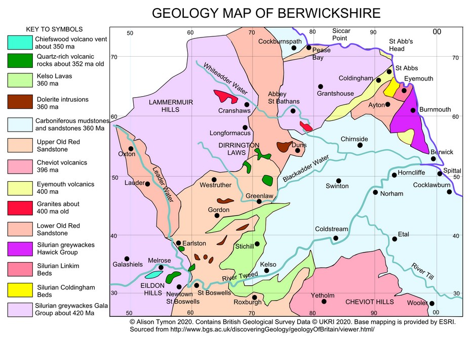
The rocks which underlie the upland areas to the north and west, such as the Lammermuirs and Ettrick Forest, are dominated by a type of sandstone called greywacke, which is resistant to erosion.
The lower Tweed valley is underlain by sandstones, siltstones and mudstones interrupted by many volcanic lavas, plugs and intrusions, such as the Eildon Hills near Melrose and the lavas of the Kelso area.
The high cliffs east of Pease Bay are formed of greywacke but are interrupted at St Abb’s Head and Eyemouth by volcanic rocks, whereas south of Burnmouth the sandstone and limestone cliffs are less dramatic.
Upland landscapes are influenced by glacial erosion whereas the valleys and the extensive lowlands around the River Tweed contain thick sequences of glacial and alluvial deposits.
The fossils contained in some of the rocks, particularly the plants, fish and tetrapods, have been researched over the last 150 years and are of scientific importance.
Greywackes, sandstones and igneous rocks have been quarried in some places, so building stones in small towns and villages give clues to the local geology.